
From 12–14 June 2023 I had the chance to attend the 2023 Open Geospatial Consortium (OGC) Tiling Interfaces Code Sprint at Moonshot Labs (a division of National Geospatial‑Intelligence Agency, USA) in St. Louis, Missouri. Open Geospatial Consortium
Here’s a retrospective of my experience—what I learned, what stood out, and how it all ties to my work as KORTxyz.
Setting the Scene
Walking into Moonshot Labs, the atmosphere felt both intense and friendly: a small group of practitioners and developers converging around shared geospatial standards, open formats, and real-world implementations. The sprint was explicitly about APIs, encoding standards and databases for map tiles—and you could feel the urgency of “making this work” beyond just theory. Open Geospatial Consortium
Participants ranged across organisations: from US Army Geospatial Center, UK Defence Science & Technology Laboratory, to University of Maryland, Pixalytics Ltd, and various universities and private firms. Open Geospatial Consortium
For me, as KORTxyz—working with digital terrain and height-models plus temperature data—it was rich ground. Map tiles, vector tiles, tiling APIs: these are the underpinnings for performant, interoperable geospatial services.
What I Did & Learned
Here are some of the key take-aways from the event:
Exploring the Standards
The sprint focused on a select few standards & specs:
- OGC API – Tiles — an approved standard for Web APIs retrieving geospatial info as tiles. Open Geospatial Consortium
- OGC API – Maps — a candidate standard for serving spatially referenced maps/charts. Open Geospatial Consortium
- Changesets API — prototype spec from OGC Testbed-15, foundation for transactional tiles. Open Geospatial Consortium
- Vector Tiles Extension to GeoPackage — prototype extension to the GeoPackage standard to support vector tiles. Open Geospatial Consortium
- Variable Width Tile Matrix — a grid designed for global coverage in geographic CRS. Open Geospatial Consortium
- Also, the classic Web Map Tile Service (WMTS) standard as a baseline. Open Geospatial Consortium
I spent time trying out vector tiles served by OGC API – Tiles, importing into QGIS, working with GeoPackage containers, and watching how different participants tackled interoperability issues.
The Workshops & Mentors
A real bonus: the mentor stream offered three entry-level tutorials:
- Serving vector tiles via OGC API – Tiles. Open Geospatial Consortium
- Compliance testing for implementations. Open Geospatial Consortium
- A web-based product demo implementing several OGC standards. Open Geospatial Consortium
As someone with terrain/height data, I appreciated seeing how a beginner could go from “how do I call this API?” to “how do I visualise in GeoPackage or QGIS?”—though I also noted the gaps (more on that below).
Outcomes & Real-World Demos
At peak, there were ~50 active users remote, and about a dozen in person. Open Geospatial Consortium
Some standout demos and deployments:
- QGIS + GDAL workflows to download vector/map tiles via OGC API and store into GeoPackage. Open Geospatial Consortium
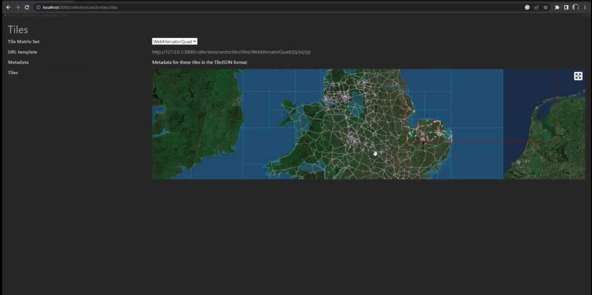
- A vector-tiles distribution of the Ordnance Survey Zoomstack product accessed through OGC API – Tiles interface (I saw a screenshot of a map created by KORTxyz from that distribution!). Open Geospatial Consortium
- Compliance testing via open-source tools like TEAM Engine. Open Geospatial Consortium
For me, witnessing this live gave confidence: the geospatial standards world is moving into practical territory—not just “this could work” but “it is being used”.
My Reflections as KORTxyz
Here’s what I took away, and what I plan to bring back into my work:
What Went Well
- Community & collaboration: The mix of government, academia, industry meant I got exposure to a wide range of problems and solutions.
- Practical implementation: Watching vector tile serving, GeoPackage workflows, API interaction—they’re directly relevant to how I build and deliver spatial models (e.g., my DHM + temperature data).
- Standards in action: It’s one thing to read a standard, another to implement and debug it. The sprint gave the “debug the corner cases” experience.
- Networking & mentorship: I had one-on-one time with mentors; picked up pointers I wouldn’t find from spec documents alone.
Where I Spotted Gaps (and Opportunities)
- The documentation for implementing OGC API – Tiles still lacks in places—especially around “tileset resource placement” and how to handle certain relation types (e.g., ‘conformance’ strings vs URLs). Open Geospatial Consortium
- For beginners (or someone switching into this space, like me was), there could be more step-by-step journeys: from “I have tile data” to “I deploy an API” to “I consume in QGIS”. The sprint noted that too. Open Geospatial Consortium
- Although vector tile work is underway, more work is required for full specification maturity and best practices. Open Geospatial Consortium
- The need to prepare participants ahead of the sprint with “pre-briefs” or materials so they get more out of the event. Open Geospatial Consortium
Looking Forward: What I’ll Do
- I’ll integrate OGC API – Tiles into my workflow: for serving my terrain + temperature data as tiles, which could boost performance and interoperability.
- Explore GeoPackage + vector tiles for packaging my spatial data in a way that downstream users (GIS analysts, web apps) can easily consume.
- Draft internal documentation for my team: “From data → tile service → client map visualization” inspired by what I saw.
- Consider contributing to best-practice docs or open-source tools—this community vibe makes me want to give back.
- Keep an eye out for the next OGC code-sprint (they invited participants) and perhaps propose a workflow or demo of my own.
Final Thoughts
Attending the 2023 OGC Tiling Interfaces Code Sprint was a highlight of my year working as KORTxyz. It’s rare to be in a room (or hybrid room) where the people working on the standards, the implementers, and the early-adopter practitioners all converge. I left with fresh ideas, concrete workflows, and a renewed sense of the possibilities of open geospatial standards.
If you are working with spatial data, tiles, APIs, or interoperability—even tangentially—I’d highly recommend keeping an eye on the OGC code-sprint series. It might just change how you build your geospatial stack.
Thanks for letting me share my experience! If you like, I can draft a version of this blogpost for your website (with images and formatting) or pull in more technical detail (e.g., sample code snippets). Would you like me to do that?
